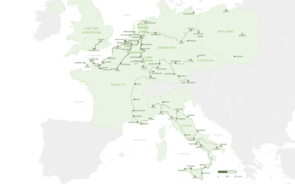
Liberation Route Europe hiking trails network is a unique transnational memorial stretching 10,000km and tracing the Allies’ advance to liberate Europe during World War II.
Developed in cooperation with hiking associations across Europe, the trails will form a traceable link between the main regions along the Allied Forces’ advance across Europe. The routes will pass numerous historical locations and tell stories told from a multitude of perspectives that were important in the last phase of World War II.
A Cultural Route of the Council of Europe
In 2019 Liberation Route Europe became a certified Cultural Route of the Council of Europe. This prestigious label means it is part of a collection of transnational thematic routeswhich demonstrate, how the heritage of the different countries and cultures of Europe contributes to a shared and living cultural heritage.
Hiking Organisations
European Ramblers Association
Founded in Germany in 1969, the European Ramblers’ Association (ERA) is an umbrella organisation comprising of 65 walking organisations from 35 European countries, along with their 3 million individual members.
FFRandonnée (France)
FFRandonnée is a French hiking association which is present throughout mainland France and overseas. The organisation is represented by 115 regional and departmental hiking committees, bringing together some 3,500 local associations or hikers’ clubs.
GR Sentiers (Belgium)
GR Sentiers association is based in the Wallonia and Brussels regions of Belgium. Its 350+ volunteers maintain trails markers, defend their routes, write and publish well-known topo-guides, and initiate and promote various hiking- related activities.
Wandelnet (The Netherlands)
Since 1980 the Wandelnet Foundation has been working with their partners and their 900+ volunteers to protect and preserve the vulnerable infrastructure of walkers in the Netherlands, and ensure that walking is safe and attractive.
GTA (Belgium)
The Maison de la Randonnée – GTA Belgium was initiated in 1985. The association is recognised by the Commissariat Général au Tourisme and works in close collaboration with professional partners active in the promotion of paths and trails, including tourism organisations.
OLAT (The Netherlands)
OLAT is a walking sports club from the Netherlands. For 55 years, OLAT has been committed to hiking by walking itself and enabling others to walk too.
FederTrek (Italy)
Federtrek – Excursionism and Environment, is an association for social advancement founded in 2010. Through its affiliated associations FederTrek carries out a variety of activities related to hiking, cycling, mountain biking, trekking and more, including thematic excursions on topics related to the environment, youth education, excursions for people with disabilities, alpine activities, guiding courses and trail maintenance.
Lincolnshire Area Ramblers (United Kingdom)
Lincolnshire Area Ramblers are part of The Ramblers, a charity dedicated to removing barriers so everyone can enjoy walking in green spaces and to preserving and improving hundreds of thousands of miles of well-loved paths, tracks and trails across England, Scotland, and Wales.
Types of trails
Long distance hiking trail
The Liberation Route Europe hiking trails projects includes two types of trails / routes. The first of these is the long-distance hiking trails have been developed to link the various counties and regions along the Liberation Route Europe.
These international hiking routes rely primarily on pre-existing long-distance hiking trails such as GR or E-paths. When deviations are needed to link an important historic site or location, LREF has worked with hiking organisations and other regional and local partners to make the optimal connections.
Local Trails & Themed Routes
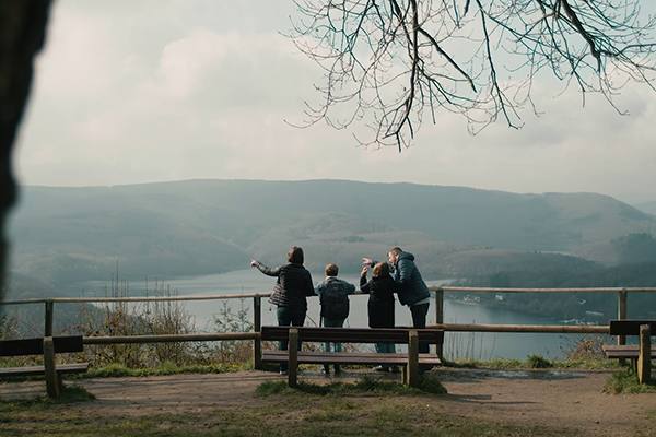
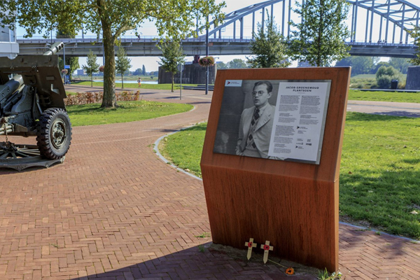
The second type of trails / routes on the Liberation Route Europe is the local or themed routes. Certain sections of the hiking trails follow dedicated themes, passing monuments and information panels with stories linked to a particular sequence of events, important battles, or the movements of a certain unit of soldiers. The stories and information provided along the route comes from a multitude of perspectives, really bringing the history to life and enriching the hiking experience.
Journey Planner Website & App
Liberation Route Europe website
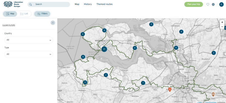
On the Liberation Route Europe website you can discover many WWII remembrance sites and stories across Europe, following in the footsteps of history from your own desktop. Read or listen to the multi-perspective stories of those who experienced this period of history and find out more about the points of interest dotted along the transnational route.You can create your own free account and use the journey planner feature to plan your own route, selecting your favourite sites and stories along the way. Alternatively, choose one of the themed routes and their ready-made itineraries.
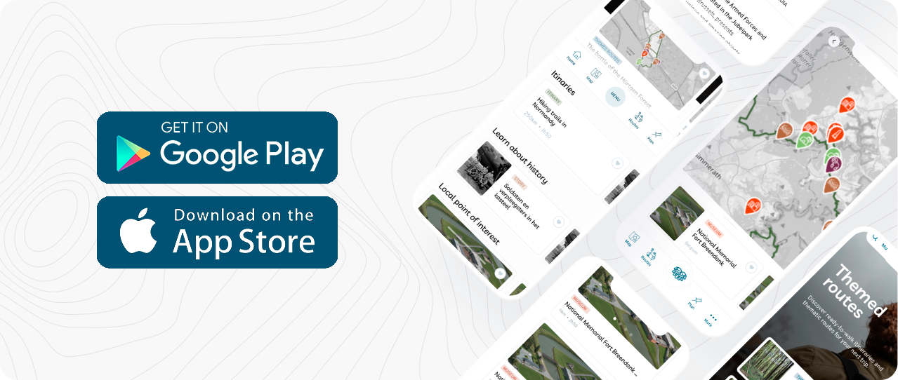
Designed to accompany you as you explore the hiking trails, the Liberation Route Europe mobile applications include all the information available on the website, including the journey planner feature. Pick a section of the trail, or themed route you would like to explore, and use the app’s GPS system to guide you along the route. Once you have set up a free account, you can also sign in and view any trails, sites or stories you have favourited by desktop or on the app and create your own itinerary to follow. The Liberation Route Europe app is available on Android and Apple.
The Tour & Travel Guide is the ultimate tool to inspire travel trade operators to include the Liberation Route Europe in their own tours and packages. Seven map-based country booklets tell the stories and mark the key remembrance sites in nine European countries, and a general booklet provides detailed information about the travel trade activities of the LRE Foundation.